Search
> Media PoolLive: 3 p.m. weather cut-in – tracking Invest 93 and Louisiana flood concerns
Clip ID 2605230
Clearance
Add to
Share
Add to Review Link
By Request
By Request assets are not available for immediate purchase.
This content has not been pre-checked for copyright.
Per clip rates are for 20 seconds of final usage. If you are using more then 20 seconds or need a different file format or have questions about clearances contact us
Description
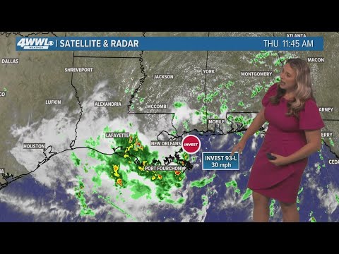
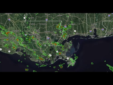
We’re live with a 3 p.m. weather cut-in for July 17, 2025, as southeast Louisiana remains under a Flood Watch.
A tropical disturbance in the Gulf, Invest 93, continues to bring waves of heavy rain across the region.
⚠️ Current threats:
A Flood Watch is in effect through late Friday night
Rainfall totals could reach 2–4 inches, with some areas over 6 inches
Storms may produce 2–4 inches of rain per hour, especially during peak heating
Breezy at times with urban flooding possible
🌊 About Invest 93:
Located just east of Louisiana, Invest 93 has a low chance of further tropical development
Due to its proximity to land, it's unlikely to strengthen—but still poses a significant rain and flood threat
🌡️ Today’s outlook:
80% chance of storms
Passing downpours with breaks
High: 87°
Stay with WWL for radar updates, street-level alerts, and continued impact coverage.
📲 Turn on WWL app alerts for flood safety info: https://www.wwltv.com/connect
📺 Stream full forecasts and cut-ins on WWL+: https://www.wwltv.com/watch
🌐 Follow WWLTV.com for ongoing coverage: https://www.wwltv.com/
#WWLWeather #Invest93 #FloodWatch #LiveRadar #LouisianaStorms
Station
WWL